The LiDAR (Light Detection and Ranging) market in North America is poised for exponential growth, transforming the way industries approach mapping, surveying, and geospatial data collection. LiDAR technology, which uses laser light to measure distances and create detailed 3D models of physical environments, is revolutionizing various sectors, including transportation, infrastructure, environmental monitoring, and defense. With advancements in LiDAR technology, North America is on the cusp of a new era in geospatial mapping, data analytics, and autonomous systems.
This article delves into the factors driving the growth of theNorth American LiDAR market, the diverse applications of LiDAR technology, and the future prospects of this groundbreaking technology.
LiDAR Market
LiDAR Technology Overview
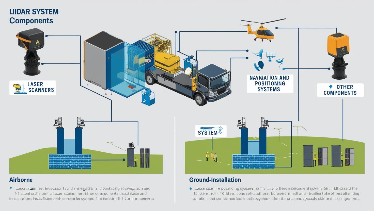
LiDAR works by emitting laser pulses toward a target and measuring the time it takes for the pulse to return. This allows LiDAR sensors to calculate precise distances, creating detailed, high-resolution 3D point clouds of the scanned objects or landscapes. The technology is employed through airborne, terrestrial, and mobile LiDAR systems, each suited for different types of data collection.
The LiDAR industry is projected to grow from USD 1.6 billion in 2024 to reach USD 3.7 billion by 2029; it is expected to grow at a Compound Annual Growth Rate (CAGR) of 18.2% from 2024 to 2029.The growth of the LiDAR market is driven by surge in the demand for 3D imagery in application areas, rise in the development of smart cities and infrastructure projects, emergence of 4D LiDAR, rising adoption of LiDAR systems in UAVs.
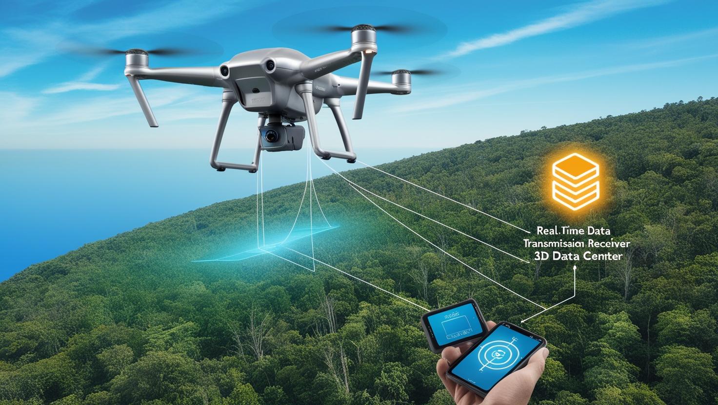
Airborne LiDAR is mounted on aircraft or drones, making it ideal for mapping large geographical areas, including forests, rivers, and urban landscapes.
Terrestrial LiDAR is typically used for ground-based applications like surveying, construction, and architecture.
Mobile LiDAR is integrated into vehicles or other moving platforms and provides a dynamic method of capturing data as it moves through an environment.
With high accuracy and the ability to collect vast amounts of data rapidly, LiDAR is becoming the go-to technology for a variety of applications.
Driving Forces Behind the North American LiDAR Market Growth
The North American LiDAR market is experiencing significant growth, driven by several key factors:
Technological Advancements LiDAR systems are becoming more advanced, with improvements in sensor resolution, data processing capabilities, and cost-efficiency. As these systems become smaller, lighter, and more affordable, their adoption across industries is becoming more accessible. The development of solid-state LiDAR has also paved the way for smaller and more reliable systems, particularly for use in autonomous vehicles.
Adoption of Autonomous Vehicles Autonomous vehicles are one of the primary drivers of LiDAR growth. LiDAR sensors are integral to the navigation and safety systems of self-driving cars, providing precise data for 3D mapping, obstacle detection, and object recognition. North American companies like Waymo, Tesla, and Uber are investing heavily in LiDAR technology to enable safer and more efficient autonomous driving systems.
Smart Cities and Infrastructure Development As urbanization increases, North America is focusing on building smart cities with improved infrastructure and sustainability. LiDAR technology is being used to create accurate digital models of cities for planning and development. Urban planning, road design, and construction projects are leveraging LiDAR to monitor existing structures, optimize building designs, and ensure efficient land use.
Government Initiatives and Funding Government investment and funding in infrastructure projects and geospatial data collection are contributing to the growth of the LiDAR market. Initiatives like the U.S. National LiDAR Initiative, which aims to develop and standardize LiDAR data collection, have fueled the adoption of the technology in government mapping projects, natural resource management, and environmental monitoring.
Environmental Monitoring and Disaster Management LiDAR is increasingly being used for environmental monitoring, particularly for tracking forest management, coastal erosion, and flood risk assessments. The high precision of LiDAR data helps monitor changes in the environment over time, aiding in climate change adaptation and disaster management. Floodplain mapping and landslide detection are examples of how LiDAR is being utilized to prevent damage and save lives in North America.
Geospatial Data and Surveying LiDAR has long been a core tool for surveying and geospatial data collection. With its ability to quickly capture accurate data over large areas, LiDAR technology is replacing traditional surveying methods that are time-consuming and less accurate. The technology is heavily utilized in land development, mining, and construction sectors, where precise data is critical to project success.
Key Applications of LiDAR Technology in North America
Transportation and Infrastructure LiDAR technology plays a pivotal role in transportation and infrastructure development. For example, it is used in roadway scanning and railway monitoring, allowing for the creation of detailed maps to improve safety, monitor road conditions, and identify structural issues. Airborne LiDAR is also used in large-scale projects, such as highway planning, bridge design, and tunnel construction, providing accurate terrain data and identifying potential obstacles.
Autonomous Vehicles and Robotics LiDAR is one of the foundational technologies for autonomous vehicles and robotics. It enables these systems to perceive their surroundings and make decisions based on high-resolution, 3D environmental data. North American automotive giants and tech companies are heavily investing in LiDAR for autonomous vehicle navigation, as well as for applications in robotics for industrial automation and delivery drones.
Agriculture and Forestry The agriculture and forestry industries are embracing LiDAR to monitor crops, forests, and other natural resources. Terrestrial LiDAR is used to measure tree heights, assess forest health, and evaluate crop yields. In precision agriculture, LiDAR sensors help optimize planting patterns, irrigation systems, and crop management by providing detailed maps of farmland and soil conditions.
Environmental Management and Natural Resource Monitoring LiDAR plays an important role in environmental management by providing detailed data for tracking natural resources such as forests, lakes, and rivers. LiDAR-based elevation data helps in monitoring soil erosion, riverbed mapping, and wetland conservation. Additionally, coastal LiDAR is used to track shoreline changes, monitor flood risks, and provide data for coastal protection projects.
Urban Planning and Smart Cities LiDAR is a critical tool in the development of smart cities. It aids in urban modeling, providing data that supports effective infrastructure planning and management. LiDAR data is used in the development of 3D models of urban environments, helping planners visualize structures, assess environmental factors, and manage space utilization more effectively.
Cost Considerations: Despite decreasing prices, LiDAR systems can still be expensive, particularly for smaller businesses or startups. However, the ongoing advancements in technology and competition in the market are likely to drive prices down further.
Data Processing: LiDAR systems generate vast amounts of data that require powerful software and processing capabilities. Developing more efficient data processing techniques and platforms will be essential to maximizing the potential of LiDAR technology.
Integration with Other Technologies: To fully harness the benefits of LiDAR, it needs to be integrated with other technologies such as artificial intelligence (AI), machine learning (ML), and Internet of Things (IoT). These integrations will help automate processes, analyze data more efficiently, and create more intelligent systems for autonomous navigation and urban planning.
Despite these challenges, the future of LiDAR technology in North America looks bright. As industries continue to adopt and refine LiDAR applications, the market is expected to witness increased investment, innovation, and market growth.
The North American LiDAR industry is experiencing a transformative shift, driven by technological advancements and the growing adoption of LiDAR in a wide range of industries. From autonomous vehicles to environmental monitoring, LiDAR is reshaping how data is collected and analyzed. As the demand for accurate, real-time mapping solutions continues to grow, LiDAR will remain a key enabler of innovation, shaping the future of transportation, infrastructure, and urban development. The integration of new technologies like AI, coupled with the increasing accessibility of LiDAR systems, will only accelerate the market’s growth in the coming years.
Frequently Asked Questions (FAQ) – North America LiDAR Market
1. What is LiDAR technology?
LiDAR (Light Detection and Ranging) is a remote sensing technology that uses laser pulses to measure distances to objects and surfaces. It captures highly accurate, high-resolution 3D data of the physical world, creating detailed maps and models. LiDAR is used in various applications, including surveying, mapping, environmental monitoring, and autonomous vehicles.
2. What are the key applications of LiDAR in North America?
LiDAR technology is being widely adopted across several industries in North America, including:
Autonomous vehicles: Providing real-time 3D data for navigation and safety.
Transportation and infrastructure: Mapping roads, railways, bridges, and highways for planning and maintenance.
Urban planning and smart cities: Assisting in infrastructure development, land management, and environmental modeling.
Agriculture and forestry: Measuring tree height, assessing crop health, and monitoring natural resources.
Environmental management: Monitoring coastline changes, flood risks, and forest management.
3. How does LiDAR work?
LiDAR systems emit laser pulses that bounce off objects and return to the sensor. By calculating the time it takes for the light to return, LiDAR systems can measure the distance between the sensor and the object. This data is used to create 3D point clouds, which can be processed to generate detailed maps or models of the scanned area.
4. What are the types of LiDAR systems?
There are three main types of LiDAR systems:
Airborne LiDAR: Mounted on aircraft or drones, typically used for large-scale mapping of landscapes.
Terrestrial LiDAR: Ground-based LiDAR systems used for detailed surveying, building modeling, and site inspection.
Mobile LiDAR: Installed on moving platforms such as vehicles, allowing for dynamic mapping and data collection.
5. What is driving the growth of the LiDAR market in North America?
Several factors are contributing to the rapid growth of the LiDAR market in North America, including:
Advancements in LiDAR sensor technology, making it more affordable and accessible.
Increasing demand for autonomous vehicles and smart cities.
Government funding and initiatives for infrastructure development and geospatial data collection.
The growing need for accurate and high-resolution mapping for urban planning, disaster management, and environmental monitoring.
6. What are the challenges faced by the LiDAR market?
Some of the key challenges in the LiDAR market include:
High initial cost: LiDAR systems can be expensive, especially for smaller businesses or startups.
Data processing: LiDAR produces large volumes of data that require powerful software and processing capabilities.
Integration with other technologies: Integrating LiDAR with AI, IoT, and machine learning to enhance its capabilities is an ongoing challenge.
7. How is LiDAR used in autonomous vehicles?
LiDAR is a critical technology for autonomous vehicles, providing precise 3D mapping and real-time data about the vehicle’s surroundings. It helps with object detection, obstacle avoidance, and route planning, allowing self-driving cars to navigate safely in complex environments.
8. What is the future outlook for the LiDAR market in North America?
The future of the LiDAR market in North America is very promising, with continued advancements in technology, growing demand for autonomous vehicles, and expanding use in smart cities and infrastructure projects. The market is expected to experience significant growth as LiDAR systems become more affordable, efficient, and integrated with emerging technologies like AI and machine learning.